The Prototype
About
Right now Big Forest Data tells us a lot about canopy height, land use changes, and vegetation density, but accessing (and using) this data for local advocacy is difficult for civil society groups because of cost, capacity, and data quality issues.
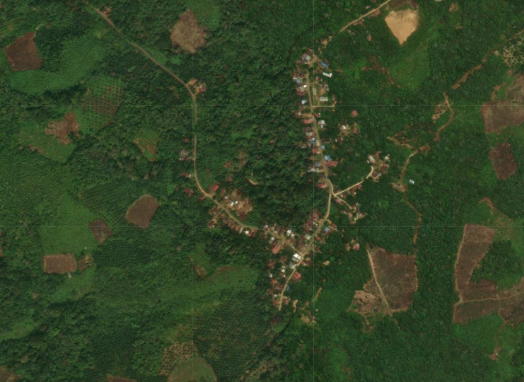
Our data prototype connects global carbon datasets with community-created maps of conservation traditions in Mekar Raya, a village in Indonesia’s West Kalimantan regency. Indonesian Kalimantan is part of Borneo, a rugged island in Southeast Asia’s Malay Archipelago that also includes the Malaysian states of Sabah and Sarawak, and Brunei.
In Spring 2025, Beyond Carbon partnered with the College of Computing, Data Science, and Society at University of California, Berkeley. As part of the Ds-Discovery Program, we created a data visualization workflow alongside undergraduate student team members Henry Hong, Sarah Ryu, and Ryan Sing Chan.
This data interface prototype allows the user to toggle between global carbon datasets and the Mekar Raya community’s own participatory map. What emerges are clear overlaps between local conservation practices and high carbon stock (HCS) areas, proving that community stewardship and ecosystem health are inseparable from one another.
How We Triangulated Datasets
This prototype was created with a combination of satellite imagery, laser measurements from NASA’s Global Ecosystem Dynamics Investigation (GEDI), and airborne LIDAR to map the forests surrounding Mekar Raya village.1
We prioritized three high-level variables as indicators of ecosystem health: canopy height, above ground biomass, and indicative high carbon stock areas.
-
Canopy height matters because taller trees store more carbon dioxide. In other words, taller trees are removing more CO₂ from the atmosphere. Measured from the ground to the top of a tree’s crown canopy height also becomes a reliable predictor of how much wood and biological matter a forest contains (both of which are crucial for carbon accounting).2
-
Above ground biomass is the total weight of all living plant material above the ground, measured in tons per hectare. About half the weight of biomass is carbon - trees are roughly 50% carbon by dry weight.3
-
Indicative high carbon stockareas are notable for their exceptionally large amounts of carbon, accumulated over centuries. High carbon stock forests are prioritized for conservation; in fact, cutting down these forests releases high levels of CO₂.4
What the Prototype Reveals
Above ground biomass measures how much carbon is locked up in forests and high carbon stock flags the forests that matter most. Taken together, these numbers tell national governments, climate negotiators, and carbon market proponents exactly how much carbon (and money) is at stake in protecting specific forests.
But our goal was to reveal community contributions to forest carbon, particularly in the form of traditional stewardship practices like the Indigenous Dayak tembawangs, a silvicultural system spanning generations in West Kalimantan.5 To visualize the spread of tembawangs, we turned to data from the Mekar Raya community’s participatory mapping process conducted in 2023.
When tembawangs are layered above canopy height, above ground biomass, and high carbon stock as the fourth variable, overlaps between community-stewarded areas and carbon-dense forests are substantially greater than neighboring areas that were not managed by the community. The prototype shows, in quantifiable terms, that the areas stewarded by the community for generations are measurably more carbon-dense than neighboring unmanaged forests.
Data-Powered Advocacy for Territorial Recognition
‘Proving’ the value of Indigenous stewardship using ‘carbon’ as the common language strengthens Indigenous and Local Communities’ (IPLC) demand for territorial recognition and doubles as a climate justice demand for securing planetary well being.
For Mekar Raya, this approach to showcasing their tembawang management system as a high-carbon area is a valuable advocacy tool in the community’s fight to protect their forests from extractive outsider interests (monoculture plantations, illegal timber harvesting).
Indonesia's protected forest designations and 'ICCA' (territories and areas conserved by Indigenous peoples and local communities) registration processes rely on evidence that a given area has ecological significance.6 Carbon stock data layered onto community maps strengthens such formal designations even further.
The prototype takes something the Dayak community has always known and practiced—caring for fruit orchards that carry deep socio-cultural and ecological significance —and makes that relationship visible. Byvisualizing a community’s relationship with its landscape, local knowledgecrosses over into national and global conversations about carbon, forest governance, and Indigenous rights.
Next Steps
In 2026, our goal is to organize 1-2 pilot data wrangling workshops with technologists already embedded in land & forest rights movements. We will create a step-by-step toolkit that outlines how to configure locally relevant carbon data from global datasets and calculate the carbon sequestration potential of community-specific conservation traditions.
- A high-resolution canopy height model of the Earth | Nature Ecology & Evolution ↩︎︎
- Very high resolution canopy height maps from RGB imagery using self-supervised vision transformer and convolutional decoder trained on aerial lidar ↩︎︎
- Aboveground Biomass, Landcover, and Degradation, Kalimantan Forests, Indonesia, 2014 | NASA Earthdata ↩︎︎
- Canopy top height and indicative high carbon stock maps for Indonesia, Malaysia, and Philippines ↩︎︎
- Comparative study of aboveground biomass and carbon storage between Tembawang and conventional rubber agroforestry in West Kalimantan Indonesia | Acta agriculturae Slovenica ↩︎︎
- Mekar Raya village government completed the ICCA registration process, including participatory mapping of village boundaries and community-designated sacred areas, in 2022. ↩︎︎